 Explore the Heart of South Africa: Nature, Culture, Adventure
Mount Rupert
Afrikaans name: Mount Rupert
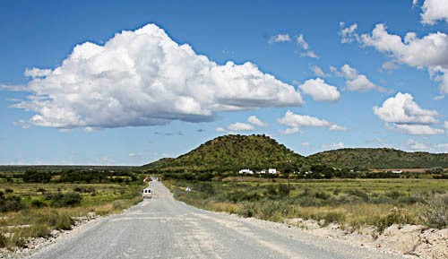
Above - Approaching Mount Rupert
Photo © Johan van Zyl
Mount Rupert is a small village in the Northern Cape province of South Africa. It is situated near the junction of the R370 and R371 roads. Spitskop Hill is located on the eastern edge of the village.
The Harts River, which is located nearby, is downstream from Spitskop Dam. The dam is only 5 km away from Mount Rupert and was built to provide water for irrigation purposes. Work on the dam was completed in 1975 but it had to be rebuilt in 1989 after flooding in 1988. The dam also offers some reasonable fishing with Carp and Barbel being caught.
Although the area around Spitskop Dam has been affected badly by overgrazing and other human activities, it is quite a good birdwatching site, particularly for waterbirds. The checklist for the area is over 200 species.
The climate in this region is hot and dry and the rainfall is unpredictable. There is some agriculture along the course of the Harts River.
There are no accommodation options in Mount Rupert a number of towns such as Warrenton, Barkly West and Delportshoop are not too far away.
References and further reading
MindatThis website features affiliate links, meaning we’ll earn a small commission if you purchase through these links.
Copyright Steven Herbert Projects, 2013 - 2025. All rights reserved.