 Explore the Heart of South Africa: Nature, Culture, Adventure
Olifants River
Afrikaans name: Olifants rivier
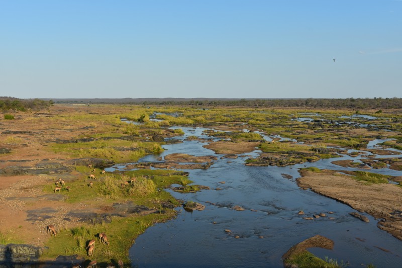
Olifants River in Limpopo province
Photo © Steven Herbert
Limpopo
The Olifants River bisects Kruger National Park and, in parts, is the boundary between the provinces of Limpopo and Mpumalanga. Near the eastern boundary of the park, and South Africa, it is joined by the Letaba River and then flows into the Massingir Dam in Mozambique. The name 'Olifant' is the Afrikaans name for 'Elephant'.
The river has a broad valley even though the river itself is often reduced to a number of streams which create numerous sandy islands. These areas make for good game viewing as various mammals, such as Impala, Waterbuck, Elephant and Cape Buffalo browse on the grasses in the river bed.
Visitors to Kruger National Park can only view the river in the area around Olifants Camp. Good spots to look for mammals and birds are the low-level bridge near Balule Camp and the high bridge on the H1-4/H1-5 tar roads.
The best scenic views of the river have to be those from Olifants Camp which offers panoramic views over the river.
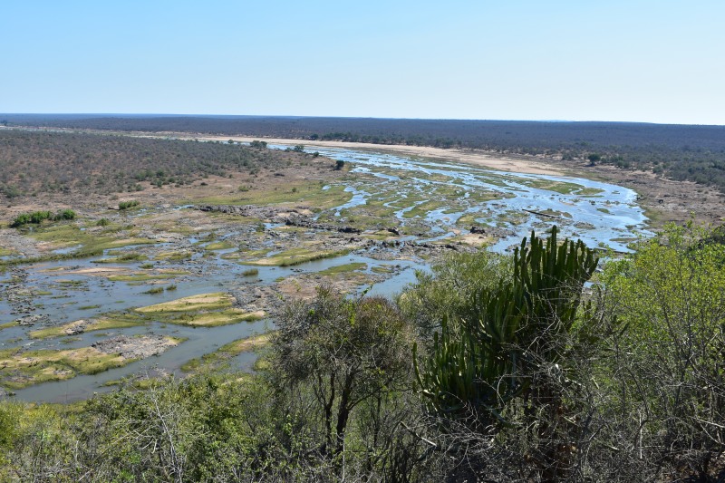
The view of the river from Olifants Camp is simply stunning
Photo © Steven Herbert
References and further reading
Wild Issue 32 - Author: - Published: 2015 - Page: 70For more info: Wikipedia
This website features affiliate links, meaning we’ll earn a small commission if you purchase through these links.
Copyright Steven Herbert Projects, 2013 - 2025. All rights reserved.